Drone and DGPS surveys of Land
What is Drone and DGPS surveys of Land?
DGPS surveys and drone surveys are powerful tools that have revolutionized the way we collect and analyze geospatial data. By providing accurate and detailed information about the land features and characteristics, these technologies are helping to improve our understanding of the environment and support more informed decision-making in a variety of fields.
How do DGPS surveys work?
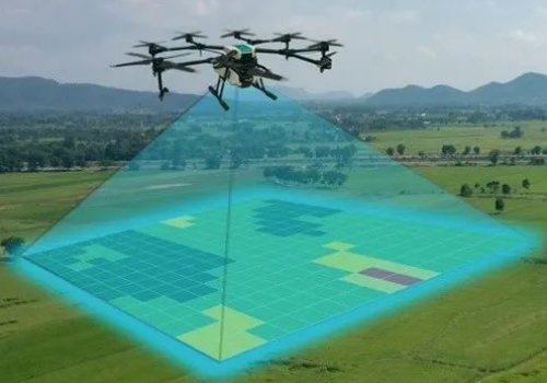
Drone Image Acquisition
The camera captures images from multiple angles, which are then stitched together to create a complete aerial view of the area.
Generating Topographic Map
This map provides information on the elevation, slope, and contour of the land, which is important for planning and development purposes.
Superimposing all the layout
Once the topographic map and land use/land cover map are generated, they can be superimposed onto the high-resolution image captured by the drone.
Identifying the Deviation
One of the main benefits of using drone surveys and DGPS surveys is the ability to identify deviations between the land acquired and the land actually under possession.
Output
The output of a DGPS survey and drone survey includes a detailed topographic map and land use/land cover map, which can be used for a variety of purposes, including urban planning, environmental management, and land use regulation.